Pages

Monday, October 31, 2011

BANGLADESH NATIONAL MUSEUM , NATIONAL MUSEUM BANGLADESH, NATIONAL MUSEUM

Bangladesh National Museum
DHAKA


The Bangladesh National Museum originally established on 20 March 1913, albeit under another name, and formally inaugurated on 7 August 1913, was accorded the status of the national museum of Bangladesh on 17 November 1983. It is located Shahbag, Dhaka. The museum is well organized and displays have been housed in several departments like department of ethnography and decorative art, department of history and classical art, department of natural history, and department of contemporary and world civilization. The museum also has a conservation laboratory.

Ground floor

The ground floor consists of some old guns in the entrance and the hall where the people book their tickets or assemble to hear the history of the museum. The hall leads to a grand staircase. Beside the hall there is a smaller room which also acts like the hall (it is also used by the guides to tell the visitors about the history) and a simple staircase.

Frist floor:

The 1st floor is divided into 22 rooms.

1st room: The first room consists of a large map showing the map of Bangladesh and the 64 districts.

2nd room: The 2nd room consists of an under going work of a large statue of the Royal Bengal Tiger.
3rd-10th room:  These rooms consists of natural beauties found in Bangladesh. In one of the room there is showcase of a tongue of a whale. 
10th-22nd room: The other rooms contains some historic relics of Bengal up to 1900. There is a room which shows the different boats used by the rural people.

2nd floor

The 2nd floor consists of photos of famous people and showcases the Bangladesh Liberation War and the Language Movement of 1952. There are posters used in the war, a torture machine and much more. There are also two libraries.

3rd floor:

The 3rd Floor consists of Pictures of International politicians, artists, scientists, famous pictures and three international galleries- Korean, Iranian and Swiss.

Gallery Index

 
1. Bangladesh in Map
 2.  Rural Bangladesh
 3.  Sudarbans
 4.  Rocks and Minerals
 5.  Plants of Bangladesh
 6.  Flowers Fruits and Creepers
 7.  Animals
 8.  Birds of Bangladesh
 9.  Mammals of Bangladesh
10. Elephant
11. Life in Bangladesh
12. Boats of Bangladesh
13. Tribes of Bangladesh 1
14. Tribes of Bangladesh 2
15. Potteries
16. Archaeological Artifacts
17. Sculpture 1
18. Sculpture 2
19. Architecture
20. Inscriptions
21. Coins, Medals and Ornaments
22. Ivory Works


23. Arms and Weapons
24. Metal Works
25. Porcelain and Glass Ware
26. Rest Room
27. Dolls
28. Musical Instruments
29. Textile and Costumes
30. Embroidered Quilt
31. Wood Carvings 1
32. Wood Carvings 2
33. Manuscripts and Documents
34. Traditional and Miniature Painting
35. Shilpacharya Zainul Abedin Gallery
36. Contemporary Art 1
37. Contemporary Art 2
   38.  Bangladesh's Struggle for  Independence Bangalee Bangladesh War of Libaration-1
39. Bangladesh's Struggle for  Independence Bangalee Bangladesh War of Libaration-2
40. Bangladesh's Struggle for  Independence Bangalee Bangladesh War of Libaration-3


41. World Civilization
42.  Western Arts
43. Portraits of World Intellectuals
44. a. Chinese Corner
       b. Korean Corner
       c. Iranian Corner
       d. Switzerland Corner

SHIVA TEMPLE AT PUTHIA, PUTHIA TEMPLE, LARGE SHIVA TEMPLE PUTHIA

The Shiva Temple
RAJSHAHI


The Shiva Tempel was built in the 19th century by then queen of Puthia. The temple, as the name suggests, is dedicated to the Hindu god known as Shiva.

Shiva temple

Today, it stands as the largest temple of Shiva in Bangladesh. The Shiva Temple shows some features of Jaipur architecture. It also houses one of the largest black basalt Shiva Linga in the country.


Left-hand side to enter the market of putiya, Large Shiva Temple is located on the south. The main gate is located on the south side of the temple.

The Shiva Linga at the Shiva temple

There are Four corners in the four side and a central peak (stone temple) in the middle. The central peak is about twenty meters high. This temple(Shiva temple puthiya) is a significant achievement in the temples of puthiyaya.


During the War of Liberation of Bangladesh in 1971, the temple was severely damaged due to fighting.The temple is now a protected monument.


RINKHYONG RIVER

Rinkhyong River
 RANGAMATI

Rinkhyong River satellite view

Rinkhyong River  a number of small streams originating from eastern hills of Mizoram (India) and meeting together at the uppermost part of the Rinkhyong reserves are known as Rinkhyong. The river makes a torturous journey through the deep reserve forests and falls into kaptai lake near Belaichhari (Rangamati) about 30 km above Rinkhyongmukh, its original place of confluence with the karnafuli. The river is flashy and is 77 km long. It is navigable up to Gobachharimukh during wet season and further above it is used only for floating timber and bamboo.

KAPTAI LAKE

Kaptai Lake
RANGAMATI


Kaptai Lake the largest man-made freshwater body in bangladesh. though created primarily for hydroelectric power generation, it contributes to produce significant quantity of freshwater fishes,navigation,flood control and agriculture. It is located in the Kaptai Upazila under Rangamat District of Chittagong Division. The lake was created as a result of building the Kaptai Dam on the Karnaphuli River, as part of the Karnaphuli Hydro-electric project. 

 Map of kaptai lake

The Kaptai Lake's average depth is 100 feet (30 m) and maximum depth is 495 feet (151 m). Its important morphometric and hydrographic features are as follows: surface elevation 31.1m, surface area 58,300 ha, volume 524,700 cu m, total annual discharge 1,707,000 cu m, storage ratio 0.31, mean annual water level fluctuation 8.14m, growing season 365 days, total dissolved solids 76 ppm and specific conductance 144 µmhos at 25ºC.

The scheduled passenger boat
The 'H'-shaped Kaptai Lake has two arms, joined by a narrow gorge near Shubalong, a part of the old Karnafuli river. Kasalong, the right arm of the lake, is fed by two streams, the Mayni and the kasalong, in the north and laterally by the Karnafuli. The left arm, Rangamati-Kaptai is fed by two streams, the Chengi in the north and the Rinkhyong in the south. The Karnafuli forms three prominent loops one at Rangamati, one at Dhuliachhari and the other at Kaptai. The Rangamati and the Dhuliachhari loops are now under the reservoir of the earth-filled dam. The Kaptai Lake has drowned almost the whole of the middle-Karnafuli valley and the lower reaches of the Chengi, Kasalong and Rinkhyong rivers.


Geologically, the lower part of Kaptai Lake, in and around the Kaptai-Rangamati region (ie Kaptai Syncline), is composed mainly of yellowish brown, fine to medium grained, massive to cross-bedded sandstone with alternating shale and silty shale (Tipam Sandstone Formation) and the upper part is featured by yellowish brown, fine to medium grained, subangular to sub-rounded, moderately to poorly sorted, massive to thick-bedded and occasionally cross-bedded sandstone with quartz granules, pebbles, clay galls and contains well preserved leaf impressions (Dupi Tila Formation).


However, around Shubalong and Barkal, the lake mainly comprises Bhuban formation. As the local people remove the protective vegetation around the lake, these rocks are exposed to the monsoon rains and thus eroded easily. This results in landslides, and the loose rock material is washed down the slopes and carried by rivers into the lake. As a result, the lake is silting up rapidly. By the early 1990s, in its 30-year existence, it had already lost about 25% of its volume due to siltation.


Apart from generation of hydroelectricity, the lake has become an important resource for some other considerations. It has created a diversified and long waterway. Many places that used to take a day or even more to reach have now become an hour's trip by speedboat or launch. It has become much easier to exploit forest resources that had earlier been inaccessible.

fishing

The whole lake is now a great tourist attraction. The lake's contribution to the development of agriculture and fishery is significant. Since the water level of the lake is maintained at different heights in different months of the year, the lakeshores are under an automatic irrigation system and are very fertile. People practice controlled farming in about 6,075 ha of land on leasehold basis through agreements with the local government.

carrying wood

DAM  Built in early sixties Kaptai Dam and the lake are the main attractions of Kaptai. If you are not visiting Kaptai separately then, don’t forget to go for a boating up to Kaptai on the Kaptai Lake while you go to Rangamati tour.

Kaptai dam

Sunday, October 30, 2011

KAPTAI NATIONAL PARK

Kaptai National ParK
RANGAMATI


The  Kaptai National Park is located in Rangamati Hill District over Karnaphuly and Kaptai Ranges under Chittagong Hill Tracts (South) Forest Division. It is accessible by air, road or train from Dhaka upto Chittagong then by road. Stablished in 1999
Kaptai National Park is exclusive for its huge plantations of 1873, 1878 and 1879, the preliminary act of modern forest management in this Indian sub-continent. At about 5464 hectors of land covered with the area of Kaptai National Park.


You can find plenty of old tree which were planted in 1873! This colossal plants and wild life of Kaptai National Park mystify the whole nature. There are a huge collection of plants in Kaptai National Park. You may feel a little bit nostalgic about your past in green village to the huge greenery of Kaptai National Park. In Kaptai National Park, there is a number of wild life like- Deer, elephant, Jungle cat, Monkey etc. Many species of Birds may also a matter of interest for the tourists and bird’s lovers. Kaptai National Park is a safe and sanctuary for birds and other wild life. Forest division founded picnic spot, restaurants in this Park. So, it will be a fascinating experience for you to visit Kaptai National Park.

 Wild Orchids of Kaptai National Park
Kaptai National Park is sited in Rangamati District over Karnaphuly and Kaptai Ranges under Chittagong Hill tracts (south), Forest Division. It is adjacent to Kaptai Bazar in the North- Eastern corner of Kaptai Upazela, Rangamati District.
The stifling rain forest on the bank of river Kornophuli is amazing in the Kaptai National Park. Kaptai Forest Rest House, Kaptai Mukh Forest Rest House, some picnic spots in the Kaptai National Park are other attractions of National Park. You can do boating, cruising, skiing, hiking in the Kaptai National Park.


Little wonder then that the Kaptai National Park is already amazingly popular with the locals. Some 50 000 people visit the park each year, paying an entrance fee of Tk10.00 per a person in support of this pleasurable wilderness. While most spend their time picnicking, others may go boating or speed boat cruising, water skiing or hiking. Great food can be found at a number of nearby restaurants for those looking for something a bit more substantial after a day spent in the great outdoors. The Kaptai National Park is relatively easy to reach.

THE HANGING BRIDGE, JHULONTO BRIDGE

The Hanging Bridge (Jhulonto Bridge)
RANGAMATI


Bangladesh Parjatan Corporation (BPC) built this Hanging Bridge over the Kaptai Lake which affords a convenient vantage point for taking in the beauty of the lake. This bridge is made during 1984 or around that time.It is the prime spot for tourists.


When you cross over the hanging bridge, definately feel the nature`s beauty. While crossing the bridge you could see the greenery of this place. This bridge leads to another hill over the canal close to the Parjatan motel. The man-made Kaptai lake, spreading over 680 km of crystal-clear water was formed by damming the Karnaphuli river, and has a picturesque hinterland of large hills and panoramic forests. A cruise on the calm waters of the lake can be a memorable experience.


Location: BPC, Rangamati, Chittagong, Bangladesh

KAPTAI DAM

Kaptai Dam
RANGAMATI

Kaptai Dam
Kaptai Dam
Kaptai Dam The most notable dam of the country which has been constructed on the karnafuli river at Kaptai in Rangamati district, 65 km upstream of Chittagong. It is 670.56m long and 45.7m high. The width at the foundation level is 45.7m and at crest level 7.6m. The crest level is 36m above mean sea level (MSL). The quantity of total excavation was 113,400 cu m (4.05 million cubic ft). Since it is an earthen dam a 16-gated spillway (each 12.2m by 11.3m) with discharge capacity of 625,000 cusec has been constructed on the left side of the main dam. The catchment area of the reservoir is 11,000 sq km. Average annual rainfall is 2,500 mm over the catchment and average annual flow to the reservoir is 12 million ac-ft. The full reservoir level above mean sea level is 33.23m and the reservoir area and capacity at this level are 777 sq km and 5.25 million acr-ft, respectively. The dead storage at 23.16m above MSL is 1.18 million ac-ft. Flood storage capacity is 0.83 million ac-ft.

Kaptai Dam
Karnafuli Hydro Power Station
The generation of Hydroelectric power is the main purpose of the lake. Other utilities include navigation, flood control, fishery, recreation and tourism. The present generation capacity of the karnafuli hydro power station is 230 MW during peak load hours. The downstream flood peak in the Karnafuli river can be reduced by 50% by storing water in the reservoir. Usually all floodwater during May to August is stored. A cargo transfer system with overhead trolleys facilitates transfer of boats, timber logs and other commodities from the reservoir side to the downstream side in the river. The panoramic view and boating facilities of the reservoir upstream of the dam offer a good recreation area and attract many visitors.
The Karnafuli Hydro Power Station was first contemplated in 1906 and a brief reconnaissance was carried out. The study was taken up again in 1923. In 1946, EA Moore submitted a report recommending a dam site at Barkal about 65 km upstream of the present dam site at Kaptai. In 1950, Merz Rendal Vatten, Consulting Engineers, proposed a site for the construction of a dam at Chilardak, about 48 km upstream of Kaptai and in 1951 government engineers proposed a site at Chitmoram about 11 km downstream of Kaptai. Finally, in 1951 under the guidance of Khawja Azimuddin, then Chief Engineer (Irrigation), the dam site was selected at Kaptai. Preliminary work started in 1951 and the government engineers did some physical work. The US Government agreed to assist in the implementation of the project and in 1952 the International Engineering Co Inc (IECO) was engaged for a study of the project through the International Cooperation Administration of the USA. On the basis of these studies the project was taken up and IECO was appointed for the engineering services of the project. Utah International Inc was engaged as the construction contractors and started working in October 1957. 

Kaptai Dam
In 1962, the initial phase of construction was completed, comprising the dam, spillway, penstock and powerhouse with a generation capacity of 80 MW by means of two units, each with a capacity of 40 MW. The third generating unit with an installed capacity of 50 MW was completed in November 1981. The project was financed by government, ICA and DLF loan and the total cost including the dam with ancillary structures, Units 1, 2 and part of Unit 3 was Rs 503 million with a foreign exchange component of Rs 171.6 million. The government and USAID financed the remaining cost of the third unit. The total cost was Tk 274 million with a foreign exchange component of Tk 156 million. In October 1988 construction of the 4th and 5th units of the Kaptai station was completed raising the total generation capacity to 230 MW. The total cost of the extension work was Tk 1,900 million, which included a foreign exchange component of Tk 1,080 million.
Although the Kaptai dam has provided increased economic opportunities which include flood control and power generation, many local inhabitants have lost their homes and means of livelihood owing to inundation, making way for a storage reservoir. There has also been a general destruction of wilderness and open spaces, and an accompanying loss of wildlife and wildlife habitats.
@
Kaptai Dam

TRIBAL CULTURAL MUSEUM

Tribal Cultural Museum
 RANGAMATI


The only Tribal Cultural Museum in the Chittagong Hill Tracts region is in this district. It was established at Rangamati town in 1978 and run by the Tribal Cultural Institute. It preserves valuable objects and articles of different tribes representing their socio-economic, cultural and historical tradition. They are typical tribal dresses, ornaments, arms and ammunitions, coins, statues made of wood, bronze and other metals, musical instruments, ivory products, handicrafts, paintings on tribal life etc.

Open : Saturday - Thursday, 10:00 am to 4:00 pm. and closed on Friday and Public Holidays.

Saturday, October 29, 2011

BARA KATRA

Bara Katra
DHAKA


 Bara Katra - sketch by Charles D'oyly in 1823

The Bara Katra is one of the legendary monuments of Dhaka city placed on the bank of the river Buriganga and to the south of modern Chalkbazar.It is a palatial building dating to the reign of the Mughal dynasty in the Bengal region.
In 1645 Mir Abul Qasim, diwan of Shah Shuja, built the spacious Building named Bara Katra.The Bara Katra was the official residence of Mughal prince Shah Shuja, who was the second son of emperor Shah Jahan. The prince endowed it to his diwan and the builder of the serai, Abul Qasim. According to an inscription composed by Mughal poet Sa'ad ud-Din Muhammad Shirazi.

 1870 photograph of Bara Katra, taken by an unknown photographer.

Originally, the Katra enclosed a quadrangular courtyard with 22 rooms on all of its four sides. Two gateways were erected, one each on the north and south. The ruins consist of an edifice having a river frontage. The southern wing of the structure was planned on a grand scale and was marked with an elaborate three-storeyed gate containing an octagonal central chamber. The remaining portion was two-storeyed and encased by projected octagonal towers. The gateway structure is rectangular in plan. It is lofty in height and its fronton is projected towards the river.
A tall alcove rising to the second storey reduces the mass of this projection. The wall surface is relieved with panels that are square as well as rectangular and that contain a variety of decorations of four-centred, cusped, horseshoe and flat arches. Above the apex of the alcove open the windows of the third storey.

Octogonal Tower : Bara Katra

Under the alcove is the main arched entrance which leads to the guardroom. Furthermore, as one passes through two successive archways, one comes across an octagonal domed hall, the ceiling of which is plastered and bears various net-patterns and foliaged designs. The double storeyed structure resolves on both sides of the central entrance into a row of five vaulted rooms in the ground floor and living rooms with a continuous corridor on the upper one.

Likewise, the upper floors of the entrance are furnished with rooms. The three storyed corner towers are hollow and can be approached from the subsidiary structures.
Following the traditional pattern of the caravan-sarai of Central Asia, the Bara Katra was highly fortified and was embellished with all the features of the imperial Mughal style.


The Bara Katra contains two inscriptions in Persian: one records that it was built in 1053 AH (1643-44 AD) and the other contains the date 1055 AH (1645-46 AD) and confirms that shah shuja gave the building to Mir Abul Qasim to be used as a Katra on the condition that the officials in charge of the endowments (waqf) should not take any rent from any deserving person alighting therein.

More than half of the Bara Katra building was destroyed over time owing to neglect. The building remains in a dilapidated condition. The Bangladeshi government has been unable to take charge of the monument owing to litigation and resistance from its present owners. The owners have made several alterations to the original character of the building and have also started construction of a new multi-storeyed building in the area. Urban encroachment and shanty constructions envelop the palace today.

Friday, October 28, 2011

GANDHI ASRAM

Gandhi Asram

NOAKHALI


Situated about 23 km. north-west of Choumuhani town and 2 km. east of Chatkhil at Jayag in Noakhali district. This asram was established in the memory of historic visit of the Mahatma Gandhi to Noakhali and devoted to his ideology. In 1946-47 Mahatma the protagonist of Ahimsa ideology visited this region with a view to preach peace. Historical Charka and other valuables used by Mahatma are preserved in this asram and those evoke deep respect to the unique memories of the great soul

BAHADUR SHAH PARK

Bahadur Shah Park
DHAKA


Bahadur shah park which was known Victoria park initially. This is located at Lakkhi bazar(laxmi or lokkhi bazar) or old Dhaka. It has roads all around of it. This is a small park and it may appear to you as a road circle to you.

Top of the monument : inside

This was mainly built to commemorate the several martyrs of the first Liberation War that took place in between the year 1857 and 1859, against the British rule. This memorial was the very place where the revolting sepoys along with all their civil compatriots were hanged publicly.


This park was renowned as Victoria Park till 1947. But after that its renamed as Bahadur Shah Park after the name of "Bahadur Shah II", the last Mughal Emperor. But still now, local people used to call this park as Victoria park. 


The tourists coming to Dhaka must visit this memorial park. There are many other historical spots in this part of the world, which are worth paying a visit. The location of the park can be reached very conveniently from ant nook and corner of the city.

ARMENIAN CHURCH AT DHAKA

Armenian Church
DHAKA


The churches in Dhaka are truly a great attraction of the city which has been drawing loads of tourists from all corners of the world. The visitors always enjoy a great time in visiting the churches of the city. The best of the lot in the city is the Armenian Church which was built in 1781 A.D. this is one of the churches of the city which still remains functional. The Armenian Church is comparatively smaller than the other present across the globe, but the beauty and the grandeur of the church is unmatched. The church is located in one of the narrow back streets of old Dhaka


Before the church was built, the site was an Armenian graveyard. Agaminus Catachik an Armenian gave away the place to build the church. There is a hearsay that, "Michel Cerkess, Okotavata Setoor Sevorg, Aga Amnius and Merkers Poges helped to build the church. Johan Kerupieath Cerkess, also Armenian, built a clock house beside the church. There is a rumour about the clock stating that, "The sound of the clock can be heard from four miles away. People match their watch's time with the church clock by hearing the bell's sound. In 1880 the clock stopped and in the earthquake of 1897 the clockhouse was destroyed.


In Dhaka, in the old Armenian graveyard there is a grave of the Armenian Catachik Avatik Thomas. The grave has a statue on, His wife bought it from Kolkata for the specific purpose of placing the statue on his grave. She mentioned her husband as the "Best Of Husbands" in the epitaph.

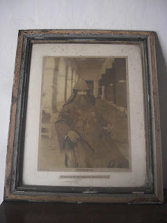
Archbishop of the Armenians 

This church has architectural consequences. Its plan is rectangular. It has arched gate and arched door. There are 4 doors and 27 windows in the church. The church is 750 feet long and the entry passage is 14 feet wide. The main square tower is into the 15 feet of the plan. The hall's floor is divided into 3 parts: firstly, a pulpit enclosed by railings, a middle section with two folding doors, and finally an area separated by a wooden fence where women and children were seated. There is a spiral staircase into the church.
Mother Teresa stayed in this church during her Dhaka visit.There are no longer any Armenians in Bangladesh. Most of the time the church remain closed.

 
Armenian Inscription

The church draws a small yet enthusiastic crowd. The churches are a place to enjoy the tranquility of heaven amidst the hustles and bustles of the city. The church is the place which supports a small Christian community from the different countries. The original founders of the church, the Armenians were the one's dealing with Bengal's jute and leather trade. Presently they have almost vanished.Now There are no longer any Armenians in Bangladesh.